
And if you plan on doing any crafting today, there is a small craft advisory for New York Harbor, including Raritan Bay and Sandy Hook Bay, until tomorrow at 6 p.m.


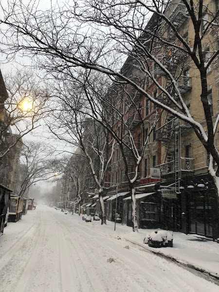
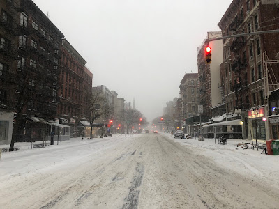
Here are a few random photos from this morning (7:30-8ish)....@NWSNewYorkNY has issued a Winter Storm Warning for NYC: Until 7:00 PM on 1/29. 5-8" of snow with wind gusts up to 45 mph expected. Avoid unnecessary travel. If you must travel, use mass transit. Info: https://t.co/ytwmuQS4K4. https://t.co/3AmmBFaUN5
— NYCEM - Notify NYC (@NotifyNYC) January 29, 2022


The New York City Emergency Management Department today issued a hazardous travel advisory for Friday evening, January 28, through Saturday, January 29. The National Weather Service (NWS) has issued a Winter Storm Warning for New York City in effect from 7 p.m. Friday through 7 p.m. Saturday, January 29.
A Winter Storm Warning is issued when heavy snow of 6 inches or more is expected to significantly impact mass transit, utilities, and cause difficult travel conditions. New Yorkers should prepare for snow covered roads and limited visibility. New Yorkers are advised to avoid travel Friday night through Saturday evening, as roads will be dangerous.
According to the latest National Weather Service forecast, light snow will develop Friday evening, becoming steadier and heavier overnight into Saturday morning. Snow will continue through Saturday afternoon and begin to taper off in the late afternoon. A total of 8 to 12 inches of accumulation is expected with this event, with locally higher amounts possible. Temperatures will be in the low 20s to mid-teens with wind chills near or below zero from Saturday morning through mid-day Sunday. Wind gusts may also be as high as 50 mph with strong gusts continuing through Saturday night, producing low visibility due to drifting and blowing snow, even after snowfall has ended.
The City's Sanitation Department has issued a "snow alert" beginning on Friday, January 28, at 4 p.m. The Sanitation Department is pre-deploying over 700 salt spreaders to pretreat roadways ahead of the first snowflake and is prepared to dispatch plows in all sectors when more than 2 inches of snow accumulates.As of 3 p.m., Key Food was holding its own with items people feel compelled to buy before any storm (bread, milk, etc.).
